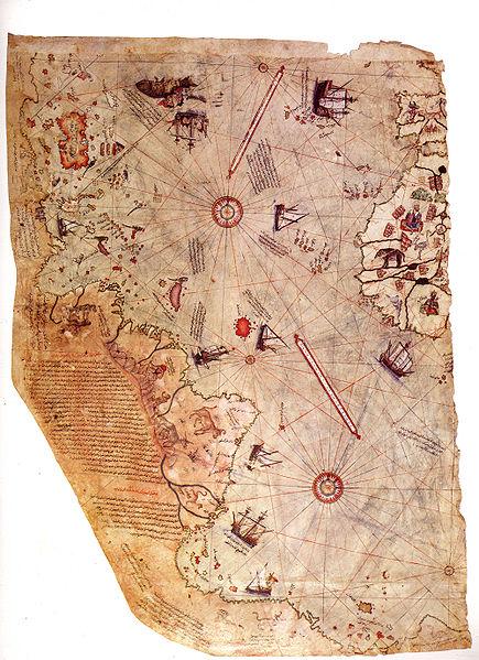
berühmte Seekarte des Osmanen Piri Reis,
mit Teilen Amerikas, 16. Jh.
Beschreibung:
The first book of volume 2 of the monumental History of Cartography focuses on mapping in non-Western cultures, an area of study traditionally overlooked by Western scholars. Extensive original research makes this the foremost source for defining, describing, and analyzing this vast and unexplored theater of cartographic history. Book 1 offers a critical synthesis of maps, mapmaking, and mapmakers in the Islamic world and South Asia.
Ein Ausschnitt aus der Einleitung:
One objective of The History of Cartography is to redefine and expand the canon of early maps. The corpus of maps (or map types) described in the previous literature on the history of cartography appears to us today unduly restricted and unnecessarily exclusive. It was based on assumptions that narrowed its scope and rendered it unrepresentative of the richness of mapping across the historical civilizations of the world as a whole. "Maps" meant, in that literature, primarily terrestrial maps, so that star maps, cosmographical maps, and imagined maps, for example, were generally excluded as ways of seeing the world. With the notable exception of the inclusion of China, cartographic history was pictured as largely a Greco-Roman invention or was narrated, for the later periods (the sixteenth century onward), as an accompaniment to the "miracle" of expanding European technology. Even within the core of accredited cartography, pride of place was given to the history of mathematically constructed-"scientific"-maps, so that the history of maps could culminate in the "scale" maps of the modern age and fit the notion of "progress" from a primitive past to a state of modern enlightenment. ...
Bitte hier weiter lesen:


